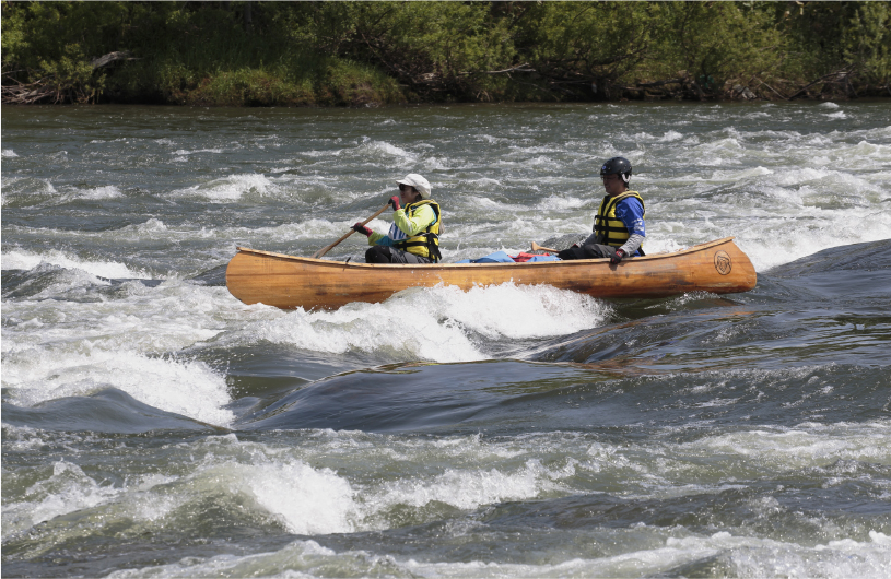
Teshio River's waves higher as the rocks approach.

Teshio River's waves higher as the rocks approach.
In the Ainu language the Teshio River is known as tesi-o-pet (river with many yana). A yana is a trap to catch fish, and the river contains many rocks that resemble yanas. Incidentally, in 1857, Takeshiro Matsuura, an explorer at the end of the Edo era, carried out surveys on the Teshio River watershed, and Hokkaido’s name was born from the hints in the words taught to him by the Ainu elders.

Onnenai Tesshi (Photo courtesy of Hokkaido Heritage Counsil)
With its headwaters on Mt. Teshiodake, the upper reaches of the Teshio River are surrounded by forests; the river comprises many meanders in the middle and lower reaches, and the Sarobetsu Plain spreads out on either side near the estuary. Canoeing can be enjoyed from the city of Nayoro in the middle reaches, to the estuary.
Local canoeists began activities to make “Japan’s longest touring event” possible, and the Teshio River Canoe Touring Event has been held every year since 1992.
Can beginners canoe down the Teshio River? We sought the advice of Kazusa Kichikawa, Chair of the Organizing Committee, and took part in the 16 km course.

Tension at the start.
Immediately after the start, it became clear that to move forward you must read the current. There are many rocks, and the height of the waves increases according to the terrain. If you fail to avoid the rocks, there is a danger that the bottom of the boat will run aground. Kichikawa advised us to “take care not to get drawn into the whirlpools”.

Kazusa Kichikawa
At a tricky section before the finish, there was a vertical row of four yana-shaped rocks and a drop that required the utmost attention. I heard calls for help and saw an overturned canoe and a boy’s kayak being swept away. Kichikawa dropped me off on the shore and went to the rescue. After witnessing that incident I realized that this is a leisure activity in which lives could be at risk.


(Photo courtesy of Hokkaido Heritage Council)
The Teshio River canoe touring event
Hokkaido Heritage Council
Website (Japanese)